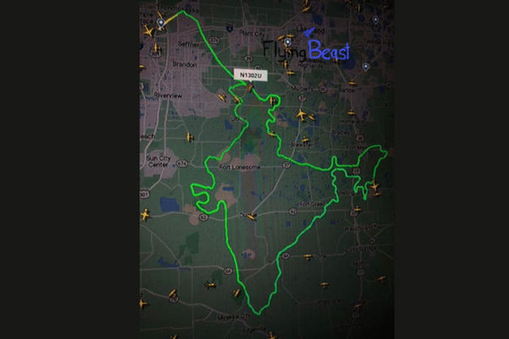
Pilot Gaurav Taneja made history by drawing the largest map of India as part of mission 'Aasman Mein Bharat'
Shortpedia
Content Team
Image Credit: twitter
Pilot, popular Youtuber, and fitness expert Gaurav Taneja drew a large Indian map in the air on the occasion of the Republic Day under his mission called 'Aasman Mein Bharat'. Gaurav Taneja has a 12 years and 6000 hours of flying experience and he accomplished this mission in a span of 3 hours by flying 350 kilometres in the sky to create a 350 km long India's map.


